SQL 110 🛢️ Spatial Data Processing and PostGIS / Geospatial Extensions
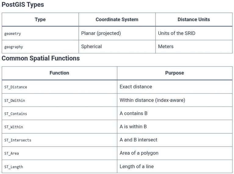
Spatial data represents information about the physical location and shape of geometric objects—points, lines, polygons, and the relationships between them . A database that can store coordinates is not automatically a spatial database. A spatial database must understand the geometry’s structure, support the operations that answer spatial questions (does this point fall inside that polygon?…